Queens Birthday weekend

Nissan Navara Forum

Help Support Nissan Navara Forum:

This site may earn a commission from merchant affiliate links, including eBay, Amazon, and others.
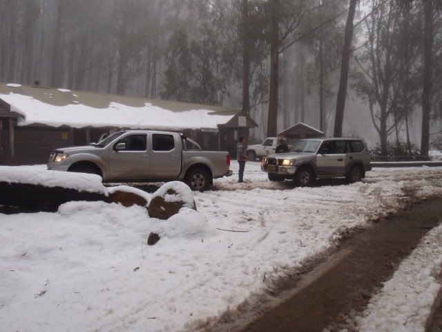
Sorry guy's I'm out too, My truk is still bent. Made the mistake taking it to a mate for repair, 2 weeks later not much has being fixed. Still waiting on a new crossmember from Nissan. You guys will have a great time plenty of rain up there lately, This is the route I had planned.

Walhalla Rd-Binns Rd, Binns Rd-Army Trk, Army Trk-fultons,Fultons-Donnelly Crk Trk,Donnelly-White Star Trk, White Star-McEvoys, McEvoys-Green Hills Link Trk, Green Hills Link-Green hills Trk, Green Hills Trk-Burgoyne Trk.
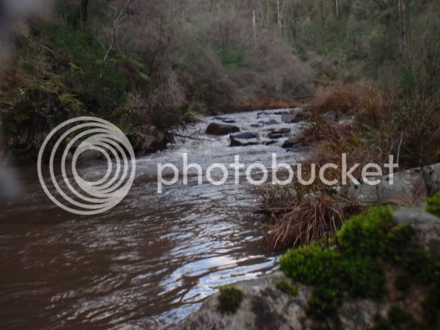
Burgoyne trk descends down to the Macalister River, great place to camp, (Probably take most of the day to do) then you can cross the Macalister, long but not to deep, then pick up the Licola RD. Head North for more driving or South to home.
 
Last edited:
That's bad news lads.

Thanks for the trip route 08.

Tigers88 and I have made new plans - but your notes may get tacked on the end if we have time.

We are looking forward to getting away.
 
Last edited:
Three D22 Nav's and four blokes (Me, Tigers88, Jonsey & Robbo) and one dog, Jet, headed off on Sunday morning.

I was carrying most of the recovery stuff - jack, shovel, straps, shackles etc, and a chainsaw.

We went to Heyfield and up to Ben Cruchan Creek Track, and across to Mt Margaret Track, crossed the road to Licola and took Burgoyne Gap Track into the Macalister Gorge Scenic Reserve where we set up camp for the night. A few beers, steak in rolls followed by roast lamb and vegies in the camp oven - sensational.
Despite the rain during the week the going was quite dry, and the numerous river crossings were uneventful - except for crossing the Macalister river which had a slippery entry.
We climbed out along Burgoyne Gap Track heading towards McEvoys track. Tigers88 took a puncture on a rocky section and we all pitched in to change - but no one tightened the wheel nuts when the car was off the jack and they later rattled loose. Some quick repairs and we were on our way - however it was decided that we should not test the damaged wheel stubs on Army Track so we cruised down McEvoys Track into Walhalla and headed for home.

The trips had a few creek crossings and two decent river crossings, plenty of steep hill work with some rocky sections thrown in.

Robbo's Nav is stock with highway tyres and he and Jonsey did a great job of getting through everything.

Tigers88 had no issues getting through either (except for the wheel nut issue - which will get plenty of mileage at work).

My Nav did very well and the new MTZ's went great and the suspension worked well enough for me to be happy.

Some happy snaps attached..
 

Attachments

  • DSCF6861.jpg
    DSCF6861.jpg
    182.5 KB · Views: 63
  • DSCF6867.jpg
    DSCF6867.jpg
    213.5 KB · Views: 63
  • DSCF6874.jpg
    DSCF6874.jpg
    183.2 KB · Views: 61
  • DSCF6877.jpg
    DSCF6877.jpg
    218.3 KB · Views: 63
  • DSCF6890.jpg
    DSCF6890.jpg
    210.6 KB · Views: 58
Last edited:
And some more.......

I have some video of crossing the Macalister River - but it seems the forum won't accept the file type - it was taken on my camera.

:cheers!:
 

Attachments

  • DSCF6895.jpg
    DSCF6895.jpg
    214.7 KB · Views: 47
  • DSCF6896.jpg
    DSCF6896.jpg
    213.7 KB · Views: 48
  • DSCF6865.jpg
    DSCF6865.jpg
    180.2 KB · Views: 40
  • DSCF6876.jpg
    DSCF6876.jpg
    218.5 KB · Views: 41
Last edited:
Looks like you got in just in time Ridgie, I heard a rumour today that many of the roads and tracks, especially in the parks, around the Gippsland area are going to be closed off soon until Sept or October because of the predicted wet weather and damage all the idiots cause to wet tracks. I haven't had the rumor fully confirmed with road and track names that will be effected but given that it happens in one form or another most winters it is to be expected I guess. Thankfully there is still plenty of places that don't get closed around here the locals can play in.
 
Looks like you got in just in time Ridgie, I heard a rumour today that many of the roads and tracks, especially in the parks, around the Gippsland area are going to be closed off soon until Sept or October because of the predicted wet weather and damage all the idiots cause to wet tracks. .


Are these more than the usual gate closures that happen after the June long weekend?
 
I don't know for sure yet because at this stage it's just media story and typically they never give all the information. The rumour suggested there might be some roads that don't usually get closed getting closed for the winter but until such time as there is an official release I'd bank on it being the usual roads at minimum. If I get a chance tomorrow I'll see if I can't hunt out something a bit more official than a media rumour, sometimes the councils give out information for road closures, especially long term ones, but the councils all around this area are fairly incompetent so they might not be the best option in this case.
 
I read last night that one of our local councils is being taking to the higher power because many of their decisions by several of the high ranking morons were done in such a manor that could see them removed from power. No idea if there is much to the story but it's about time more of these pricks were taken to task over their complete waste of ratepayers money.

That particular council doesn't control too many of our seasonal tracks which is no doubt a good thing for the 4WD community but they aren't beyond feeder road closures to stop people getting into the forests because some greenie has told them it's a little muddy.

The one thing we have got in our advantage is that there is so many tracks leading in so many directions the morons in their ivory towers don't know half of them so while their closures can effect many of the mapped areas it doesn't effect the locals who want to get from point a to point b and get a little dirty doing it. Also too many road closures effect the log trucks around here and while the greenies have a lot to say about that all the authorities here know that without the timber industry the area is dead so many road closures are only put on roads the log trucks don't use.
 
Enough politics

Some pics from my weekend spent with my best mate and some of his family at Pikes Flat on the Howqua river.
Lots of snow on the nearby mountains made for a cool reception.
D40 and my mates Prado at Telephone Box Junction,Mt Stirling.
P6100142.jpg

From here we headed on to Pikes Flat to set up camp.A few rain showers but not really cold in the valley at that stage.
On Saturday,my mate sent his boy and girl off to do some fishing so we could drink beers and catch up on things.
Howqua River.
P6120162.jpg

Camp.
P6120147.jpg

They went well.Smoked Trout feed.
P6120168.jpg

On Saturday arvo the weather cleared to a nice blue sky and a starry night and stayed that way until we left on Monday.

The clear nights led to freezing cold,that and a leaky air mattress made for some uncomfortable nights in the tent,my fresh water drum turned to ice slush and we couldn't defrost food unless we put it near the fire.

Besides the cold nights,i had a great weekend ,my mate had just bought the Prado so he had a chance to test it out and the D40 only had to cope with firewood carting,which suited me fine.Passenger for a change.
 
For sure Tony,i hope to plan a trip for November that will finish on the Vic/NSW border near Thredbo,everyone will be welcome.
 
Love the pics navarian - especially the snow.

Looking forward to the November trip. Melb Cup weekend still? How many days? I need to put in for leave.

Cheers.
 

Latest posts

Back
Top